Another bit of blasting from the [near] past, now.
In which I again go ambling about the place and try to see assorted migrants. Sometimes succeeding. I also see assorted other things and am slightly more successful in getting them on the record. I like things that let you shoot them. Rocks are very good on this score, as unlike flowers and fungi, they're quite hard for chavscum to destroy [not that they don't try now and again..].
:)
While the Nose is Migrant Central* - and handily close - the Patch goes further and I would be remiss in leaving it out, so I've been beating the bounds [lemonade and so on]. As you may have read earlier, I had yomped many miles south and west, so I figured I ought to head the other way, too.
Let's see..
Surf's up..!
Where the northern Patch boundary meets the sea. Bit late in the day, but well-distanced from anyone else!
When the tide is lower and the sea less likely to kill you, there's some nice Permian geology on Watcombe Beach..
Handily landed right way up.
Lovely chunk of desert clastics here. Proximal channel deposits with a basal comglomerate, channel cut and counter-cut sands, and collapse deposits.
Close up
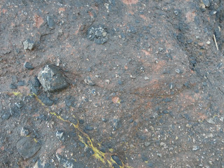
Note the erosive surface - an ~ shape - with the curve above the blocky cobble on the left [which has protected sediment next to it]. Above the channel cut, the sediment is very poorly sorted, with no FU** sequence you'd expect from a waning flow event [and as you see overall in the upper photo]. A channel has been cut in the soft sediment of the debris flow but then flow has either switched or suddenly stopped and the channel edges have collapsed inwards, giving a little fine sediment at the base and then a higgledy piggledy mix of sediment with lumps in dumped on top of it.
Enough geology for now.
Nice shady valley =
Good spot for Horsetails
Yellow Archangel ssp. argentatum
[[It turns out, Watcombe Beach is currently 'closed due to subsidence'. {Well, the roadway is a bit 'just had an earthquake'-y, but it's hardly impassable let alone dangerous on foot and you shouldn't be taking vehicles down there anyway.. but never mind}. Oh. Ooops? It should be noted that only the access lane has a sign, there's nothing at all on the coast path in either direction...]]
Right then, some assorted sceneries;
Stover this is not,
but every Patch has its little
'oh if only...'s
Not only for MPs, then
[No cliche avoided]
[No cliche avoided]
Familiar view from different angle
Unfamiliar view
First Garden Warbler of the year up there - well, down slope a bit to be exact.
Following the coast path
The Coastguard!
[surprise]
Currently our only air ambulance...
No other surprises this time, but that's how it's been; the odd [usually lone] good bird and not a lot of anything else. Is it just me? Or have there not been even numbers of regular birds this year? Especially considering how we're all putting extra local hours in, too...
Guillemots aside - they seem to be about right, though no Big Scope counts to be sure they're not a few tens down - at least.
Be Seeing You...
[[*This is very much a relative term, unfortunately.]]
[[** Fining Up; as usually the energy is waning when sediment starts getting deposited in an event {be it a flood or just the tide coming in!}, so big bits fall out first and then progressivly smaller bits land on them.***]]
[[*** This is for a single event, mind. FU and the opposite CU for multiple units are to be expected. The former when say water depth is increasing {eg. in coasts when the sea level is rising, so you get sandy shores to muddy deeper water to fine silt deep marine sediment} and the latter when the energy is increasing as water shallows {for example when continents collide****}.]]
[[**** Geology works on very different scales sometimes!]]


No comments:
Post a Comment